

Stereo Photogrammetry
Accurate three-dimensional models can be constructed using multiple photographs of the same object or area taken from different angles. This process is called stereo photogrammetry. Modern methods use computer programs to associate related photographs and perform the necessary triangulation, and use algorithms to increase estimation accuracy and minimize error.The resulting point clouds can be processed into traditional topo maps as well as digital elevation models accurate to <5cm.

Data/Image collection
The precision and resolution of the resulting 3D model is limited by the quality and quantity of the photographs, as well as the range of angles at which the photographs were taken. Any additional information such as ground control points or a known position and orientation of the camera can increase accuracy and reduce computation time, as the program would otherwise have to estimate these.
In the terms of aerial photography performed by UAS, these factors are determined by not only the capabilities of the camera, but also the ability of the aircraft to provide a stable platform and favorable shooting angles at precisely known positions.
Agisoft PhotoScan
Agisoft PhotoScan is a stand-alone software product that performs photogrammetric processing of digital images and generates 3D spatial data to be used in GIS applications, building and structure documentation, as well as volumetric measurements. Using local software ensures Data security and control over the quality of the data output.
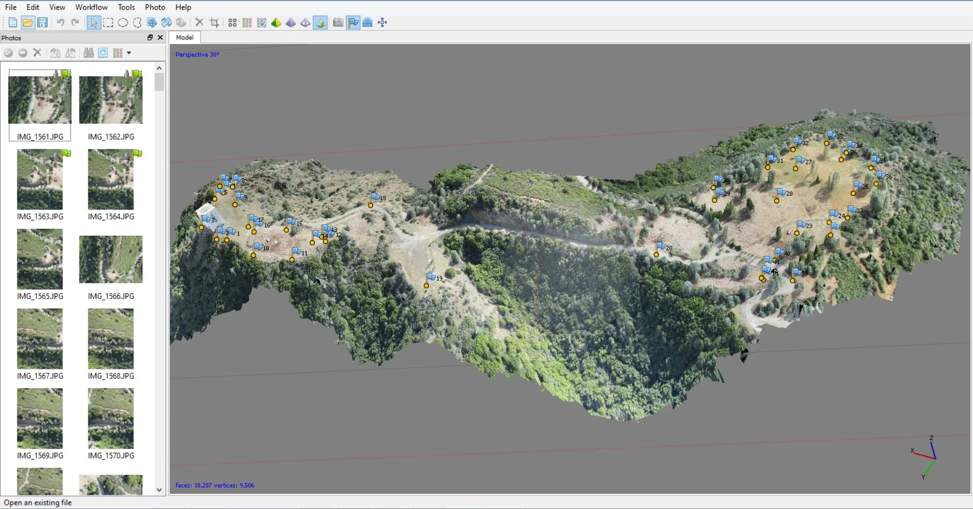
You can see in the Agisoft screen shot, the individual photos on the left and the completed textured 3D mesh on the right. The blue markers indicate the ground control points set out by high precision RTK GPS and are registered in the final model.
As part of a complete aerial mapping system, AeroTestra is a re-seller of Agisoft software and can include the license as part of your system. You can request a thirty day trial of the software here